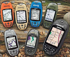
The essential GPS platform for mobile GIS

The Trimble® GeoXM™ handheld, from the GeoExplorer® 2005 series, is an affordable, all-in-one solution for taking your GIS to the field. With 1 to 3 meter GPS accuracy, and the latest Microsoft® Windows Mobile® version 5.0 software, the GeoXM handheld is a convenient and versatile handheld that's perfect for mobile GIS applications.
Because the GPS receiver and antenna are built into the handheld computer, it's never been easier to use GPS in your application. The GeoXM handheld delivers reliable 1 to 3 meters GPS positions when and where you need them. Use the integrated SBAS receiver to get WAAS or EGNOS corrections, or use Bluetooth® to connect to a Trimble GeoBeacon™ receiver to reliably navigate back to assets, or to record new data to keep your GIS up to the minute.
The GeoXM handheld has a powerful 416 MHz processor running the most advanced operating system available—Microsoft Windows Mobile version 5.0 software. Windows Mobile is the industry standard open platform for mobile devices, so you can choose a software solution to match your workflow, whether off-the-shelf or purpose built.
There's plenty of storage space for all your GIS data, and with a Secure Digital (SD) memory card slot, you can add gigabytes of memory for all your maps. And if you need to access the Internet or your organization's secure network to get the most up-to-date data, it's no problem—the GeoXM handheld has built-in wireless LAN and Bluetooth*,so you can access information on-the-go.
Using the built-in wireless LAN and TrimPix™ technology, the GeoXM handheld can connect to a range of WiFi-capable Nikon digital cameras for automated capture of digital images. Download the TrimPix technology software and you have an ideal solution for easily collecting high resolution digital photos to link to your GPS positions.
Portable and cable-free, the GeoXM handheld is built for use in rough terrain and bad weather. Wherever your work takes you, take your GIS with you on a GeoXM handheld.
* Bluetooth and wireless LAN type approvals are country specific. GeoExplorer series handhelds have Bluetooth and wireless LAN approval in the U.S. and EU. For other countries please consult your local Reseller.
Key features:
- 1 to 3 meter GPS accuracy, with integrated SBAS
- Microsoft Windows Mobile version 5.0 software, allowing maximum flexibility in software choice
- 512 MB onboard memory plus removable SD memory
- Bluetooth and wireless LAN connectivity options
- Rugged handheld with all-day battery
- TrimPix technology for wireless camera support
Field Computers with GPS | |
| Accuracy: post-processed code | 1–3 m |
| Accuracy: post-processed H-Star | N/A |
| Accuracy: post-processed carrier | N/A |
| Accuracy: real-time code | 1–3 m |
| Everest multipath rejection | No |
| Integrated GPS and field computer | Yes |
| Integrated SBAS | Yes |
| Integrated beacon | Optional Bluetooth Beacon receiver |
| Integrated OmniSTAR | No |
| Number of channels | 12 |
| NMEA output | Yes |
| RTCM input | Yes |
| RTCM output | No |
| Operating system | Microsoft Windows Mobile version 5.0 software |
| Processor | 416 MHz XScale processor |
| Screen size | 3.5" / 8.9 cm |
| Screen details | Portrait TFT color touch screen 240 x 320 pixels |
| Logging memory | 512 MB |
| CompactFlash slots | 0 |
| SD (Secure Digital) slots | 1 |
| Alphanumeric data entry | Soft input panel (SIP) on screen keyboard, Transcriber handwriting recognition |
| Integrated Bluetooth | Yes |
| Integrated Wireless LAN & TrimPix technology wireless camera support | Yes |
| Weight | 0.78 kg (1.7 lbs) |
| Battery life | 9 hours |
| Ruggedness | Withstands 1 m (3.2 ft) drop |
| Environmental | Wind driven rain and dust resistant to IP54 standard |
| Operating temperature | –10 ºC to 50 ºC 14 ºF to 122 ºF |