The United States Government Accountability Office (GAO) issued on May 7 an alarming report on the future of GPS, characterizing ongoing modernization efforts as shaky. The agency appears to single out the IIF program as the weak link between current stability and ensured future capability, calling into doubt “whether the Air Force will be able to acquire new satellites in time to maintain current GPS service without interruption.” It asserts the very real possibility that “in 2010, as old satellites begin to fail, the overall GPS constellation will fall below the number of satellites required to provide the level of GPS service that the U.S. government commits to.”
Prepared at the request of the U.S. House of Representatives’ Subcommittee on National Security and Foreign Affairs, Committee on Oversight and Government Reform, and titled "Global Positioning System: Significant Challenges in Sustaining and Upgrading Widely Used Capabilities," the report concludes that "it is uncertain whether the Air Force will be able to acquire new satellites in time to maintain current GPS service without interruption. If not, some military operations and some civilian users could be adversely affected.”
“In addition,” the report summary continues, “military users will experience a delay in utilizing new GPS capabilities, including improved resistance to jamming of GPS signals, because of poor synchronization of the acquisition and development of the satellites with the ground control and user equipment. Finally, there are challenges in ensuring civilian requirements for GPS can be met and that GPS is compatible with other new, potentially competing global space-based positioning, navigation, and timing systems."
Among the report’s principal recommendations is a proposal often made in past years by a range of experts, but never implemented: the Secretary of Defense should appoint “a single authority to oversee the development of GPS, including space, ground control, and user equipment assets, to ensure these assets are synchronized and well executed, and potential disruptions are minimized.”
While the Department of Defense (DoD) concurred with this recommendation, and while quite possibly it might effectuate the streamlined decision-making and corollary processes to remedy the highlighted deficiencies, it would run counter to the integral “dual-use” principle of GPS as dedicated to both civil and military users. Such a move could thus conceivably and adversely affect the interests of civil users.
The full report can be downloaded from the GAO website.
Testimony from invited GPS providers and users before a related National Security Subcommittee hearing ("GPS: Can We Avoid a Gap in Service?"), some of which is briefly encapsulated within this news story, can be downloaded.
Why GAO Did This Study. A highlights document attached to the GAO report asserts that GPS “has become essential to U.S. national security.” The GAO conducted its own analysis of Air Force satellite data, in addition to interviewing key officials and analyzing program documentation. Specifically, the agency assessed progress in:
* acquiring GPS satellites
* acquiring the ground control and user equipment necessary to leverage GPS satellite capabilities
* coordinating efforts among federal agencies and other organizations to ensure GPS missions can be accomplished.
Gloomy Outcomes. Based on the most recent satellite reliability and launch schedule data from March of this year, the estimated long-term probability of maintaining a constellation of at least 24 operational satellites falls below 95 percent during fiscal year 2010 and remains below 95 percent until the end of fiscal year 2014, at times falling to about 80 percent. Program officials provided no evidence to suggest that the current mean life expectancy for satellites is overly conservative, the GAO stated.
The results of fewer than 24 operational satellites could include:
* Intercontinental commercial air carriers may have to delay, cancel, or reroute flights.
* Enhanced-911 response to emergency calls could lose accuracy, particularly operating in urban and mountainous environments — exactly where emergencies tend to be most dire and hardest to locate.
* Accuracy of precision-guided munitions could decrease, forcing the military to use larger munitions or use more munitions on the same target to achieve the same level of mission success, and increasing the risks of collateral damage. The urgent desire to decrease or eliminate collateral damage to civilians in or near conflict zones has often been cited by the founders of GPS as one of their key motivations in envisioning the program.
* Both standard positioning service and precise positioning service could suffer, impacting large numbers of civil users, both professional (for example, surveyors) and casual (users of location-based services via cell phones) in moderately mountainous areas, in large cities, and under forest foliage.
Block IIF at the Crux. Cristina T. Chaplain of the GAO presented the report to Congress, stating, “In recent years, the Air Force has struggled to successfully build GPS satellites within cost and schedule goals; it encountered significant technical problems that still threaten its delivery schedule; and it struggled with a different contractor. As a result, the current IIF satellite program has overrun its original cost estimate by about $870 million and the launch of its first satellite has been delayed to November 2009 — almost three years late.”
The GAO reports cites specific problems with the IIF satellites contracted to Boeing. During the first phase of thermal vacuum testing in 2008, one of the test payload’s transmitters failed; consequently, the program suspended testing in August 2008 to identify the causes and take corrective action. Other hang-ups include maintaining the proper propellant fuel-line temperature, delaying final integration testing, and re-design of the satellite's reaction wheels, used for pointing accuracy, because of on-orbit failures on similar reaction wheels on other satellite programs. Overall, about $10 million additional have accrued to program, according to the GAO.
“Further, while the Air Force is structuring the new GPS IIIA program to prevent mistakes made on the IIF program, the Air Force is aiming to deploy the next generation of GPS satellites three years faster than the IIF satellites. GAO's analysis found that this schedule is optimistic, given the program's late start, past trends in space acquisitions, and challenges facing the new contractor.
“Of particular concern is leadership for GPS acquisition, as GAO and other studies have found the lack of a single point of authority for space programs and frequent turnover in program managers have hampered requirements setting, funding stability, and resource allocation.
“If the Air Force does not meet its schedule goals for development of GPS IIIA satellites, there will be an increased likelihood that in 2010, as old satellites begin to fail, the overall GPS constellation will fall below the number of satellites required to provide the level of GPS service that the U.S. government commits to. Such a gap in capability could have wide-ranging impacts on all GPS users, though there are measures the Air Force and others can take to plan for and minimize these impacts.
“In addition to risks facing the acquisition of new GPS satellites, the Air Force has not been fully successful in synchronizing the acquisition and development of the next generation of GPS satellites with the ground control and user equipment, thereby delaying the ability of military users to fully utilize new GPS satellite capabilities.
“Diffuse leadership has been a contributing factor, given that there is no single authority responsible for synchronizing all procurements and fielding related to GPS, and funding has been diverted from ground programs to pay for problems in the space segment. DoD and others involved in ensuring GPS can serve communities beyond the military have taken prudent steps to manage requirements and coordinate among the many organizations involved with GPS. However, GAO identified challenges in the areas of ensuring civilian requirements can be met and ensuring GPS compatibility with other new, potentially competing global space-based positioning, navigation, and timing systems.”
Staving Off Disaster. In the course of its interviews with key officials, the GAO learned of and reports on some alternatives that have been examined. The Air Force Scientific Advisory Board considered the use of smaller GPS satellites in 2007. These could be developed more quickly and at lower cost. The board concluded that while small satellites could at some point serve to augment GPS capabilities, they would require a different and much more extensive ground control segment, program development would take too long, and necessary changes to user equipment would render the whole scheme cumbersome.
The effects of satellite power loss over time, due to harsh space conditions, could be mitigated by shutting down satellite subsystems when not needed, reducing power consumption, also by shutting off a secondary (unnamed) GPS payload. DoD has long been reluctant to take either measure absolutely, particularly the second one, but according to testimony (see below) has been implementing both practices on an intermittent basis.
Day in Congress. Other GPS community representatives testified to the House Oversight and Government Reform’s subcommittee on National Security and Foreign Affairs, alongside GAO spokesperson Chaplain.
According to Lt. Gen. Larry D. James, Commander, 14th Air Force, Air Force Space Command, and Commander, Joint Functional Component Command for Space, U.S. Strategic Command, the Space Command maintains the required minimum of at least 24 GPS satellites in orbit, and the current level of 30 operational satellites, by keeping a “ghost fleet” of older, partially mission-capable satellites in backup mode. “Currently, three vehicles are held in residual status and are returned to the constellation every six months to ensure operational capability.” He stated that added life also is being squeezed from the satellites by reducing power to or turning off equipment for secondary missions aboard the satellites.
Karen Van Dyke, acting director for Positioning, Navigation and Timing in the U.S. Department of Transportation’s Research and Innovative Technology Administration (RITA), told the Congressional committee that “GPS is vulnerable to interference that can be reduced, but not eliminated.” Citing the 2001 Volpe Report for which she was a key author, she stated that there has long been “an awareness within the transportation community of risks associated with use of GPS as a primary means for position determination and precision timing. Due to the reliance of transportation on GPS signals, it is essential that threats be mitigated and alternative back-ups be available, and the system be hardened for critical applications. DOT has determined that sufficient alternative navigation aids currently exist in the event of a loss of GPS-based services.”
Nearly simultaneously with the GAO report and congressional hearings, the long-withheld Independent Assessment Team report on eLoran as a GPS backup has just been released.
F. Michael Swiek, Executive Director, U.S. GPS Industry Council and a member of GPS World’s Editorial Advisory Board, reminded Congress of the dual-use nature of the system, saying “The U.S. Government has promoted and encouraged [GPS] development by establishing, maintaining and reinforcing a stable policy framework that has consistently received farsighted and bipartisan support. It has been a true partnership of shared visions, discussions and debates, cooperation, and coordination. This has been possible through the open dialogue that has taken place since the early days of GPS, some 25-plus years ago, between civilian and military, industry, and government on technical and policy issues as the technology, system, and applications have evolved.”
Swiek made his recommendation that “successful adoption of modernized civilian GPS signals will occur if the installed user base can continue to trust the consistent and stable policy framework that the U.S. government has provided for GPS for two decades. The new signals will need to sustain the legacy of accuracy, availability, and reliability established over the past 20 years.”
Chet Huber, president of OnStar, a wholly owned subsidiary of General Motors Corporation, and at nearly 6 million active subscribers probably the largest single group of civil GPS users, offered three recommendations:
“First, we must address the health of the current constellation. We are concerned that a recent report shows eight of the current satellites are one component from total failure. Loss of signal will likely immediately affect GPS accuracy and availability (geographic coverage).
“Second, as the GPS system is modernized, it is imperative that the U.S. government formally commit to preserving the L1C/A signal and to ensuring backward compatibility for legacy applications with no loss of performance from current levels. . . . Any modernization initiative that degrades backward compatible performance — such as reducing the number of satellites making up the constellation — would likely adversely impact the provision of services by OnStar, including the quality of location information we provide to public safety, thereby potentially increasing the response time of public safety personnel to crash victims and others in need of emergency services.
“Our third recommendation — and this is also important to legacy applications — is that we commit to maintaining the current PRN code (or satellite signature structure) for the primary orbital slots, as satellites in those slots are replaced. Legacy hardware is not capable of being expanded to accommodate more than 32 slots so renumbering above 32 will likely affect performance of legacy applications.”
Read more...
Thursday, January 28, 2010
GPS at Risk: Doomsday 2010

Garmin's Oregon 550
Overview
Garmin's latest handheld GPS receiver, is the new and improved Oregon 550 series. It picks up where the Oregon 200, 300 and 400 left off, adding a built in 3.2 megapixel camera, with automatic geocoding of where the photo is taken, a three axis compass, giving accurate readings regardless of how the unit is held and what Garmin says is improved visibility with the touchscreen. The 550 and 550t model, which adds preloaded 100k topo maps of the United States, also benefits from the firmware improvements made to the original Oregon units. In addition to the camera and three axis electronic compass, the 550 has a barometric altimeter, and the ability to share wirelessly between other compatible Garmin units. The 550 lists for $499 and the 550t for $599. Check discount prices here.
Hardware
The Oregon 550 comes in a similar package as the previous Oregon models. It does however, include an NiMH battery charger (does not rapid charge) which will charge four batteries at a time. However, the package only includes two rechargable batteries. The 550 also supports operation with lithium or alkaline AA's. There is a very brief quick start guide and the owner's manual comes on a CD-ROM. However, it is a manual for all of the Oregon models, 200 through the 550t. It is not as detailed about the features as I would have liked.
Software
First, the Oregon 550 has the same recent feature updates in the Oregon series. Waypoint averaging, waypoint edit, Sight-n-Go and even the ability to custom name a map file, with the .img extension is available. As of November 2009, Garmin released its Garmin Custom Maps, which adds incredible versatility to the unit. In December, a beta update introduced dashboards to the compass, map, elevation pages, adding even more ability to customize the Oregon. We suggest you check the Garmin WebUpdater on regular basis for these updates. I am focusing on the camera, geotagging, touchscreen and compass, since these are the main changes in this unit.
This is the main menu page, with my
own custom photo added for the
background image.
Camera
The camera is 3.2 megapixel and the images it captures are much better than I expected. (I had feared nothing more than a cell phone type camera) You have the option of setting the resolution to 3.2MP, 2MP or 1 megapixel, which will vary the file size of the image. For the 2 megapixel images, they average about a 500 KB file. For 3.2, expect about a 750 KB file per image. The camera seems to do pretty well, even for up close photos, however there is no macro function available.
Read more...
Thursday, January 22, 2009
SPOT. The World's First Satellite Messenger

The SPOT satellite network is a commercial satellite network with a proven 99.4% reliability rate. It processes over 6 million messages a month, the equivalent of 2.3 messages per second. SPOT is used by individuals who are outdoors and in business where lone work occurs - aviation, construction, fishing, forestry, government, leisure, oil & gas, utilities.
SPOT's 4 Simple Communication Functions - Just Might Save Your Life
1) Ask for help. In the event of a non-life threatening emergency, you can use this function to notify your SPOT team – the friends and family you have chosen as your contacts – that you need assistance. SPOT sends one message every 5 minutes for one hour or until Help is cancelled
2) Track Progress. Also known as SPOTcastingSM, this feature allows friends and family to follow your progress in real time using your password, or to save waypoints so you can review your entire route at a later date. SPOT sends one message every 10 minutes for 24 hours or until SPOT is powered off.
3) Check In. Also known as SPOTcheckingSM, this feature allows you to let your SPOTteam – the friends and family you have chosen as your contacts – know that all is well, notify them of your location, or save waypoints so you can review your route at a later date on Google Maps™. SPOT sends three identical messages to the SPOT service for redundancy. The first of those three messages is delivered.
4) Alert 911. Use this function in the event of a life threatening or other critical emergency to notify emergency services of your exact location and that you need assistance. SPOT sends one message every 5 minutes until power is depleted or 911 is cancelled.
Read more...
Garmin MapSource Trip & Waypoint Manager
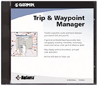

PC System Requirements:Pentium processor, Windows 98 or Later, 32 MB minimum RAM, 32MB hard disk space, CD-ROM drive, 256-Color display adapter and monitor(24-bit color reccomended), Mouse or other pointing device.
The PC interface cable for your unit is required.
Read more...
Friday, August 8, 2008
Gps Auto Navigation System Safety
If you have installed a GPS auto navigation system in your car, then you should follow a few simple rules when driving in order to maximize your safety on the road. It doesn?t matter whether you are a long distance driver using the GPS auto navigation system to plan the most efficient route possible, or just using your satellite navigation system to find a route around the traffic problems in your home town, the rules for using GPS systems safely are the same.
The first thing to check before you set off on your journey is to make sure that the GPS receiver is firmly mounted. If you have a windshield mounted receiver that uses a suction cup to hold it in place, make sure that it is firmly attached, while if your GPS receiver is mounted on the dash, check it to ensure that it is not going to fall off.
There is nothing worse than the unit falling off its mounting while you are driving, and this is a very dangerous thing to happen, especially if you start to reach around and try to reattach it while you are driving. If your system is removable, you should take it out of the car whenever you leave it parked in order to remove any temptation for thieves who might otherwise try and steal it off you.
Once you have started on your journey, and set the SatNav system up to plan your route, you should not touch it again. The SatNav should be there to assist you, not to distract you. Ideally, it will give you information about directions through the car?s audio system, and you will not need to look at the screen too often when you are driving, as this means that your attention will be diverted away from where it should be ? the road.
It is important to remember that the advice given by a GPS auto navigation system is not infallible, and it is not a substitute for common sense. If you feel that you are being misdirected, and the route that you are following is wrong, do not be afraid of ignoring the advice and following an alternative route.
When used properly, and safely, an GPS auto navigation system can provide you with all the information that you need in order to get to your destinations quickly and easily, with a minimum of fuss, and managing to avoid any traffic problems.
By behaving sensibly with your GPS auto navigation system ? making sure it is well fitted, leaving it alone when you are driving, and paying attention when you need to ? you will have a safer, quicker and more enjoyable journey than ever before, and never need get lost again.
Jason has been in the construction equipment and industrial sales business for over 10 years. He owns and operates Red Hill Supply to better serve the automotive and industrial industries. - http://www.redhillsupply.com/GPS-auto-navigation-system.htm
Read more...
Thursday, April 3, 2008
MobiHand Features 3DVU's 3D Image Navigation for Mobiles
MobiHand, a leading distributor of mobile applications and media, announced its partnership with 3DVU, the premier global provider of 3D Image Navigation and Location Services. As of today, Navi2Go US and Navi2Go UK are available worldwide on MobiHand's various distribution channels. This one-of-a-kind off-board 3D image navigation solution is offered on a range of Windows Mobile devices and is the most intuitive and efficient navigation in the mobile industry.
Navi2Go is a patented mobile application, providing 3D imagery for navigation on mobile handsets. Users can travel over the entire US at high resolution aerial imagery coupled with high-precision terrain elevation in a 3D bird-eye-view. Navi2Go is promising to address the critical decision points in navigation, eliminating exit misses and preventing getting lost. Accurate voice guidance and newly introduced 3D route guidance over 3D virtual world representation makes Navi2Go the most intuitive, friendly and easy to-get-there navigation solution. Navi2Go is now available in the US and UK for an annual service of $120 and semi-annual service of $69 through MobiHand powered websites such as Only Windows Mobile www.onlywindowsmobile.com, Pocket PC Thoughts www.software.pocketpcthoughts.com, Everything Q www.software.everythingq.com as well as additional web-based retail outlets.
"We are proud to join forces with MobiHand, offering Navi2Go to consumers all over the world traveling in the US and UK" noted Isaac Levanon 3DVU's Chairman and CEO. "Today's consumers depend more than ever on their mobile phones for navigation. 3DVU is excited to work with MobiHand, providing users with the most intuitive way to travel on the world's leading SmartPhones and mobile devices".
"MobiHand is pleased to promote and distribute this innovative navigation tool for GPS-enabled Windows Mobile devices," said David Schoenbach, Vice President, Business Development, MobiHand, Inc. "The Navi2Go Mobile service, providing GPS tracking with real aerial images, provides a compelling and useful navigation experience for people on the go."
In addition to offering the application on Windows Mobile® devices, 3DVU will release Navi2Go on Symbian® by the second quarter of 2008 and will add BlackBerry® and JAVA devices support shortly thereafter.
About 3DVU
3DVU is the world's leading provider of 3D Image Navigation and Location Services. Satellite and aerial imagery, as well as mapping data, such as point of interest and route information can now be streamed over limited-bandwidth communications with realistic 3D views and smooth maneuverability. The company is strategically partnered with carmakers, navigation systems, mobile device and handset developers, major satellite and aerial image-sensing entities, mapping and GIS data providers. 3DVU is the winner of Frost & Sullivan's Europe Telematics and Infotainment Technology of the Year Award in 2007. The company has multiple software patents. For more information, visit www.3dvu.com or demo.navi2go.com on Windows Mobile Device for a demo.
About MobiHand
MobiHand, Inc. is a leading provider of marketing and distribution services for mobile software with a rapidly-growing partner network, encompassing over 100 mobile enthusiast sites, and over 600 mobile developers. MobiHand offers a catalog of 10,000 mobile software products, from critical device utilities to games, media players, ringtones, themes, and an extensive collection of business applications. Its home store, www.mobihand.com , is accompanied by a network of stores on platform-specific sites, such as Treonauts.com, EverythingQ.com, CrackBerry.com, as well as major cross-platform sites such as GSMArena.com, Esato.com, BrightHand.com. MobiHand additionally provides mobile and online ecommerce services for its developer partners, and is continually innovating improved online and on-device ecommerce experience. For more information on MobiHand, Inc., please visit http://corporate.mobihand.com or contact partners@mobihand.com.
Source
Read more...
Friday, March 21, 2008
Use your GPS Tracking System For So Many Things
Step outside your own front door and in all likelihood Global Positioning Systems (GPS) have impacted on your daily life in some way. It could be that rush hour taxi ride across town or perhaps that weekend fishing trip. Originally developed by the US military, GPS tracking systems have a wide array of practical uses for the consumer. In general terms its two main functions are positioning – instantly locating a person or object and navigation. That may be fine for a police manhunt or a round the world yachtsman, so what can GPS do for the average consumer?
This technology can offer enhanced reassurance for worried parents. Do you really know where your teenage son or daughter goes at night? Perhaps a GPS tracking system device can help ease parental anxiety. There are units available that can specify a certain locality to monitor, so if your child strays outside this area an alert will be sent to your device. He or she will then be tracked for the remainder of their journey continually relaying data back to your device or the Internet. These units can take the form of hand held equipment, a mobile phone or a watch. There are even tiny pet tracking receivers available on the market for use on a dog collar.
The leisure industry has long since adopted GPS tracking system technology for use in outdoor pursuits. For hiking, mountaineering and deep sea fishing there are specialist devices available offering tailored functionality. A diver can safely assess how long he or she can remain at a certain depth while heart rate and blood pressure is being monitored.
In car units have become the most widely used of GPS devices as the plain old road map becomes consigned to history. Drivers have the capability to plot complicated itineraries down to the minutest detail. Cost and time savings can be made as congestion black spots and uneven terrain can be avoided with ease. Most importantly emergency services can accurately pinpoint the location of a vehicle instantly when involved in breakdown or accident. In fact a GPS tracking system can actually save you money. Most insurance companies reduce insurance premiums for vehicles with tracking capabilities. Business has also recognized the cost savings and increased efficiency that GPS provides which is often used to track and monitor individuals as well as vehicles.
Consider carefully your reason for purchasing a GPS tracking device and its usefulness to yourself, your family or business. This sophisticated piece of hardware is by no means a substitute for plain common sense. Life's risks and hazards still exist out there. What it can provide is a heightened sense of wellbeing and security for you and your loved ones and help you better manage your time in work or play. With prices starting at under $100 GPS tracking systems are within most budgets so do a little research and seek advice to determine the best options for you.
Article Source: http://www.ApprovedArticles.com
Read more...
How to use the GPS Clock
The Global positioning System (GPS) is a US military system primarily intended for global navigation. The system provides highly accurate positioning information for navigation. The GPS system consists of a constellation of 24 orbiting satellites. Each satellite has an on-board atomic clock, which is ideal for providing a highly accurate timing reference.
This article discusses how the GPS clock can be used to provide an accurate timing reference for computers and computer networks. The GPS system is often used for computer timing applications, such as NTP time servers and accurate timing references.
GPS Time
GPS time is continuously broadcast by the GPS system. Time is referenced to UTC (Universal Coordinated Time), which is the same worldwide and does not vary with time zones. GPS timing information can be received with relatively low-cost equipment, such as a GPS receiver and antenna.
The GPS signal is very weak low-power radio signal. The signal has two designated frequencies, L1 and L2. Frequency, L1, is the civilian GPS frequency transmitted at 1575.42 MHz. The signal travels in a straight line and can pass through clouds, glass and plastics but is blocked by objects such as metal and brickwork. The ideal location for a GPS antenna is therefore on rooftop with a good view of the sky. Often, antenna installation on the side of a building or in a window can provide a good enough view of the sky to give adequate results.
GPS Clock
The GPS system provides a free-to-air time synchronisation service; there are no on-going set-up or subscription charges. Many computer systems utilise the GPS clock as an accurate timing reference. Highly accurate NTP server systems use the GPS clock as an external reference to synchronise Network Time Protocol servers. Typically, a GPS receiver can provide timing information to within a few nanoseconds of UTC. The accuracy achieved with a GPS receiver is generally more than required for most computer network timing applications.
GPS Receiver Output
The GPS receiver constantly outputs position and timing information. Generally, information is transmitted to and from the receiver via a RS232 serial interface. Standard GPS interface protocols exist, the most common being NMEA. The NMEA protocol consists of a number of sentences, or character strings, transmitted at 4800 bits per second. Contained within each character string is accurate time and position information. Due to the latencies involved in serial communication, the NMEA sentences are not generally accurate enough to provide a timing reference. Therefore a pulse per second (PPS) output is utilised. A PPS output is an accurate pulse output each second that is aligned to the start of each second. The PPS output can be fed into a control line on the RS232 interface to provide a hardware interrupt input for accurate timing. Often the DCD RS232 line is utilised as a PPS input from the GPS receiver. The PPS output combined with NMEA timing and positioning information provides a highly accurate timing reference for computers.
GPS Antennas
The GPS antenna is a signal amplifier that boosts the GPS signal for transmission along a cable, usually coax, to the receiver. GPS antennas used for timing purposes are generally dome-shaped pole mounting devices for permanent installation in a static location. Typically, the GPS antenna is fairly small in size, measuring less than 900 mm in diameter
GPS Cabling
The cable distance that can be utilised by a GPS antenna and receiver depends on the amplification of the GPS antenna and the quality of coax used in the installation. A typical GPS antenna may have a gain of 35 db. Low-quality coax such as RG58 has an attenuation of 0.64 db/m at 1575 MHz. Therefore, a cable run of 55m can be obtained using RG58 cable. Higher quality coax, such as LMR400, an unaided cable run of 200m can be achieved. However, very high quality coax can be expensive. A good compromise is LMR200 cable, which can be run unaided to 80m. Longer distances can be achieved with the aid of GPS amplifiers, which amplify the GPS signal still further, to increase cable distance.
Article Source: http://www.ApprovedArticles.com
Read more...